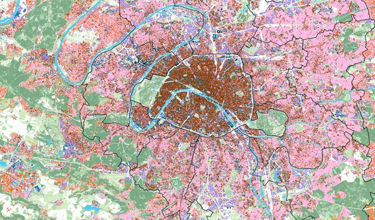
The map of urban fabrics shows the components of the cityscape.
Three aspects of buildings’ morphology are use to define the main types of urban fabric:
- The dimension of constructed elements: big, medium sized, small;
- The urban footprint: continuous, broken up, semi-detached, or standing alone;
- The height of construction.
Dimensions have been calibrated based on the major categories of buildings in the dense conurbation.
For example, detached housing units most often have a footprint of less than 200 m² and are under 10 m high; multiple family buildings built before the 1950s, both within Paris and its suburbs at the time, have footprints of under 500 m² and vary between 10 and 25 m in height, company buildings rarely have footprints of under 1,000 m², etc. This classification facilitates the coherent reading of the main territories, unities within the cityscape forming patches which group together similar types of buildings, areas where there are rifts…
So this approach based on the dimensions of buildings is applied to define a classification which does not convey their function or height but which specifies their volumetric relationships and the structure of urban fabrics whose diversity and juxtaposition makes one aware of the built up cityscape that is more or less homogenous, more or less dependent on the topography and the large road, rail and fluvial infrastructures.
