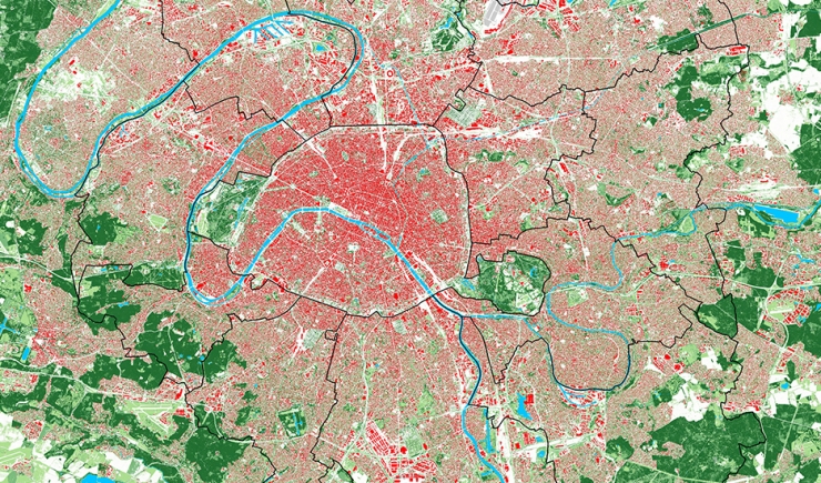
This map was made by processing InterAtlas aerial photographs which enables the surfaces of buildings and the height of areas covered by vegetation to be deducted.
It zooms in on six Grand Paris station neighbourhoods illustrating the contrasting situations in terms of the morphology of buildings and the presence of plant life.
