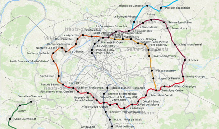
The Paris Urbanism Agency (APUR) has just produced, in collaboration with the Grand Paris Express company -Societé du Grand Paris- (SGP) and the Ile-de-France Regional and Interdepartmental Department of Infrastructures and Development (DRIEA), a datavisualisation tool which makes it possible to discover the Observatory of Grand Paris station neighbourhoods in a dynamic and interactive way.
The observatory is a tool for increasing awareness and analysing the characteristics of the future Grand Paris stations and to follow their evolution.
Observation is carried out on two levels:
- A cross-analysis of all the station neighbourhoods of a line allowing each station neighbourhood to be compared the one with the others.
- Monographs which give a detailed description of each station neighbourhood’s characteristics, placing it in its surrounding environment within the communes affected by the arrival of new stations and also in the rest of the inner ring of suburbs.
The monographs on each station neighbourhood, as well as the cross-analysis of each line can now be visualised by clicking directly on the map or on the menu bar on the right. Net surfers can discover a selection of maps and will be able to easily download any of the fifty analyses already made.
A specific section brings together themed studies which have already been published, such as cultural venues in the metropolis and the economic fabric of station neighbourhoods along Line 15 south.
For greater ease during use, the tool should be opened with Firefox or Chrome. Could you please mention the source (Apur) if you make copies of all or part of the screen?

